ubuysa
The BSOD Doctor
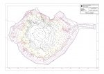
I have a .dwg file produced by some unknown CAD software that is a contour map of the below-water area of a deep lake. The base data comes from a detailed underwater survey of the lake. I'm able to visualise the structure of the lake by looking at the contours on the .dwg file, but many others can't do that and see just a jumble of lines.
What I'd like to be able to do (at no, or minimal cost) is produce a 3D rotatable model of the lake from the data in the .dwg file. I don't want to buy expensive modelling software since this is a one-off, so I'm wondering whether anyone knows of a cheap (ideally free) way to produce a 3D model?
I've attached a very reduced .jpg image of the .dwg file here and I'd like to produce a 3D model of it to supplement the geological study I've already done on the lake. There is a ton of useful evidence in this survey and it would be so handy to have a 3D model of it so that everyone can see that evidence clearly.
This isn't a big deal but since a picture (or 3D model) is worth a thousand words it would be very nice to have.

